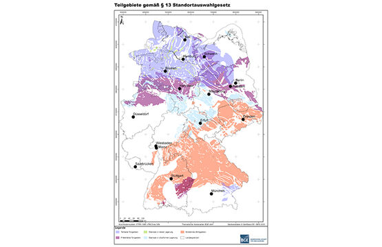
The Bundesgesellschaft für Endlagerung mbH (BGE) published the sub-areas interim report on Monday, 28 September 2020. It contains the results of the first evaluation of existing geological data on Germany’s sub-surface. The results are the areas that are unsuitable for the final disposal of high-level radioactive waste and the areas that are expected to have a favourable overall geological situation. In these places, it seems worthwhile to look at them more closely in the further proceedings.
90 sub-areas covering 54 percent of Germany’s surface area
The BGE has identified 90 sub-areas with a total area of just over 240,000 km2. However, because sub-areas partially overlap, the total area on the formerly white map of Germany is smaller: about 194,000 square kilometres or about 54 percent of the total area of Germany. “The chance of finding the site for a final repository for high-level radioactive waste in Germany that offers safety for a million years is very good. This is shown by the 90 sub-areas all over the country”, says Stefan Studt, Chair of the Management Board of the BGE.
Sub-areas are areas that are expected to have a favourable overall geological situation for the storage of high-level radioactive waste. There are both very small sub-areas (e.g. salt domes) and very large sub-areas (e.g. large clay formations), which can extend across several districts or even federal state borders. Some sub-areas look like a group of islands on the geographical map. There, a fault zone could interrupt a host rock unit in the subsurface, or a minimum requirement may not be met in one part of the formation but may be met in others.
Sub-areas in almost all federal states
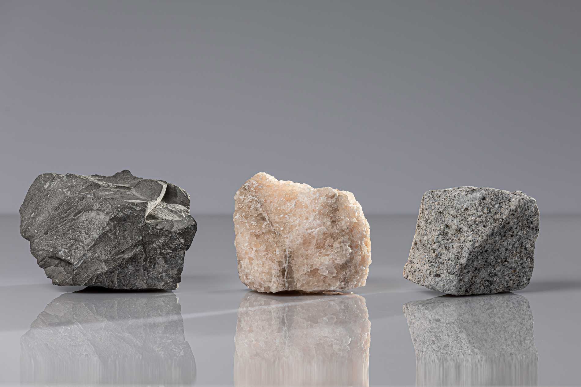
The sub-areas are distributed across all federal states – except for Saarland. In the clay rock, the BGE has identified nine sub-areas covering an area of almost 130,000 square kilometres. In the host rock salt, 74 sub-areas with an area of slightly more than 30,000 square kilometres have been designated. Of these, 60 sub-areas are located in steep rock salt formations (i.e. salt domes) and 14 in stratiform (i.e. flat) rock salt formations. Seven sub-areas with an area of almost 81,000 square kilometres are located in crystalline host rock. “It is easy to see from the size of the sub-areas that we are still a long way from a preliminary decision on a site”, says Steffen Kanitz, who is responsible for the repository site selection in the BGE Management Board. “We are now looking forward to discussing our findings, our methods for applying the criteria of the Repository Site Selection Act, and our work on new tasks with our dedicated team of scientists with citizens and the professional public”.
Gorleben is excluded from the procedure
Following the application of the geoscientific consideration criteria, the Gorleben salt dome did not become a sub-area in accordance with Section 24 of the Respository Site Selection Act. This means that Section 36, paragraph 1, sentence 5, number 1 Repository Site Selection Act applies and that the Gorleben salt dome is therefore excluded from the selection procedure. Accordingly, the Gorleben salt dome will not be considered as part of subsequent work by the BGE on proposals for siting regions.
Basis for public participation
The sub-areas interim report is the basis for the first phase of formal public participation at a time when no facts have yet been created. This gives interested citizens the opportunity to influence the results of the further repository site selection process. On 17 and 18 October 2020, the Federal Office for the Safety of Nuclear Waste Management (BASE) will launch participation with a kick-off event for the specialist conference on sub-areas.
No preliminary decision on a location yet
The sub-areas interim report is not yet a preliminary decision on a possible site for a repository for high-level radioactive waste. The aim of the next step in the site selection procedure is to further narrow down the search area from sub-areas to siting regions. The BGE implements this with the help of preliminary representative safety analyses, the geoscientific criteria, and possibly also the application of the theoretical planning consideration criteria. The theoretical planning consideration criteria include population density, nature conservation areas, water protection areas, flood plains, and cultural monuments. However, these criteria come into play only if the geological conditions at another comparable site are just as good. This is because the task of the BGE is to find the site that offers the best possible safety for a repository for high-level radioactive waste for a million years.
What happens next?
In this further course of the first phase of the site selection procedure, the BGE will develop a site proposal for regions that could be explored above ground in Phase 2, taking into account the results of the specialist conference on sub-areas. The siting regions to be explored above ground are determined by the federal legislature after prior examination by BASE and further public participation as required by law. In Phase 2, the BGE identifies sites within the scope of the surface exploration that it proposes for underground exploration. After completion of the underground exploration, the site proposal is targeted for 2031.

