


The “GeoMetEr” research project, which is being carried out by the Bundesgesellschaft für Endlagerung (BGE) in collaboration with other research partners, has been underway since March 2023. Its aim is to develop and explore geophysical measurement procedures for surface exploration programmes in two research regions. The new measurement procedures are intended to support the minimally invasive exploration of siting regions at later stages of the site selection procedure for a repository for high-level radioactive waste.
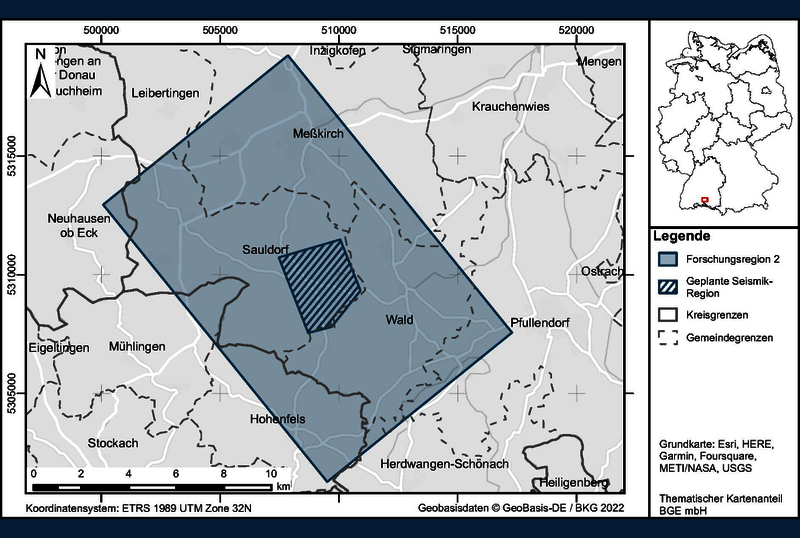
Now, the BGE has specified the precise layout of the second research region in southern Baden-Württemberg: measuring around 150 square kilometres, the region encompasses the municipality of Sauldorf as well as the adjacent local authorities of Wald, Herdwangen-Schönach, Meßkirch, Pfullendorf, Leibertingen in the district of Sigmaringen, Mühlingen and Hohenfels in the district of Konstanz, and Neuhausen ob Eck in the district of Tuttlingen – see map. The first research region is located close to the municipality of Langenweißbach in the Erzgebirge mountain range and builds on a previous research project by the Freiberg University of Mining and Technology.
Both research regions are located in areas that, according to the exclusion criteria set out in the Repository Site Selection Act (StandAG), are unsuitable as a future repository site for high-level radioactive waste. Accordingly, they will no longer be considered by the BGE as part of the site search procedure. The Sauldorf research region has been excluded from the site selection procedure based on the exclusion criterion “seismic activity”, while the Langenweißbach research region has been excluded based on the criteria “active fault zones” and “influence from present or past mining activity”.
Preparatory measurements successfully completed
Before the research region was defined, preparatory measurements were carried out by the University of Münster in order to identify possible electromagnetic interference effects (e.g. due to transmitter masts or pylons). Scientific analysis of the data identified only localised interference effects, which do not exceed normal levels and do not represent an obstacle to the planned measurements. The BGE then specified the 150-square-kilometre research region based on these results and taking account of the local geology and any potential nature reserves.
In the Sauldorf research region, there are plans to trial various geophysical measurement procedures by 2027. These procedures include a 2D seismic survey as well as magnetic and electromagnetic measurements taken from the air. In a further step in collaboration with its project partners, the BGE also plans to specify a 25-hectare area in which to carry out a high-resolution 3D seismic survey as well as sinking a research borehole with a depth of up to 600 metres. There are also plans to trial magnetic and electromagnetic measurements using helicopters and drones in autumn 2023.
Initial magnetic and electromagnetic measurements from the air and initial seismic measurements are planned in the Sauldorf research region in autumn 2023. In the Langenweißbach research region, these measurements are due to take place from winter 2023 onwards.
Further information on the “GeoMetEr” research project can be found on the BGE website at bge.de/geometer and by following the link found on that page to the research project description (PDF, 104 KB, in German only)
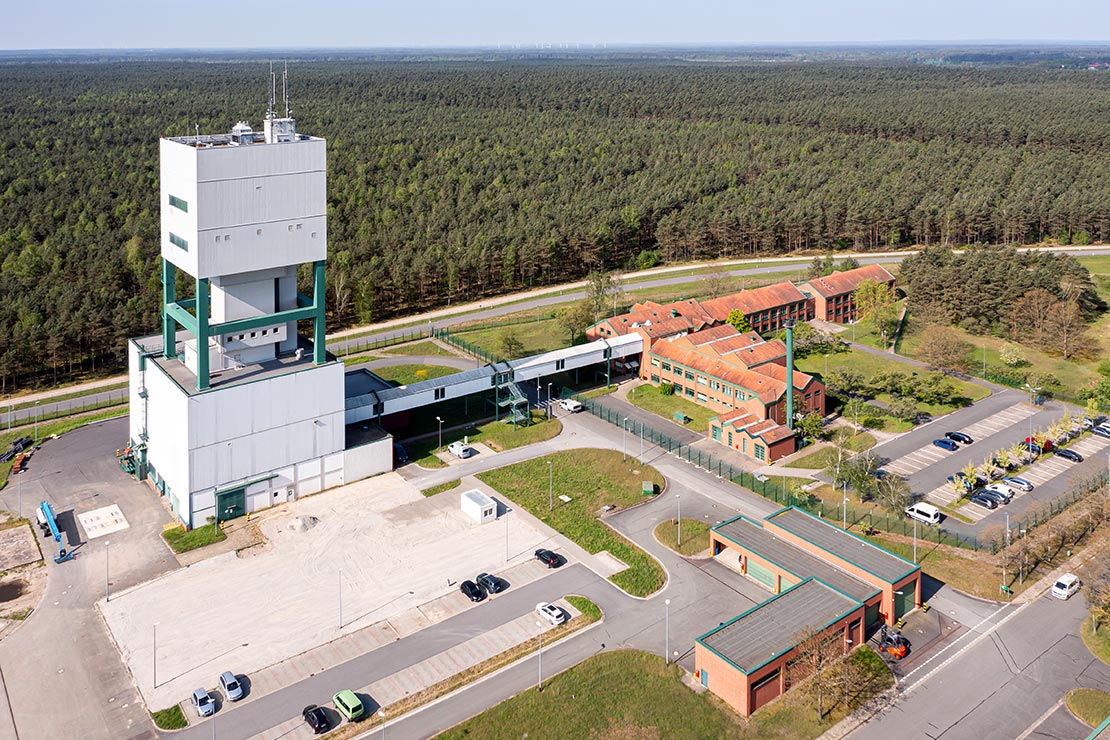
About the BGE
The BGE is a federally owned company within the portfolio of the Federal Environment Ministry. On 25 April 2017, the BGE assumed responsibility from the Federal Office for Radiation Protection as the operator of the Asse II mine and the Konrad and Morsleben repositories. In addition to the decommissioning of the Gorleben mine, its other tasks include searching for a repository site for the disposal of high-level radioactive waste produced in Germany on the basis of the Repository Site Selection Act, which entered into force in May 2017. The managing directors are Stefan Studt (Chair) and Dr Thomas Lautsch (Technical Managing Director).